Skip to content
Scan a barcode
Scan
Hardcover The Piri Reis Map of 1513 Book

ISBN: 0820321575

ISBN13: 9780820321578

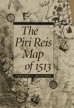
The Piri Reis Map of 1513

One of the most beautiful maps to survive the Great Age of Discoveries, the 1513 world map drawn by Ottoman admiral Piri Reis is also one of the most mysterious. Gregory McIntosh has uncovered new evidence in the map that shows it to be among the most important ever made.

This detailed study offers new commentary and explication of a major milestone in cartography. Correcting earlier work of Paul Kahle and pointing out the traps that have caught subsequent scholars, McIntosh disproves the dubious conclusion that the Reis map embodied Columbus's Third Voyage map of 1498, showing that it draws instead on the Second Voyage of 1493-1496. He also refutes the popular misinterpretation that Reis's depictions of Antarctica are evidence of either ancient civilizations or extraterrestrial visitation. McIntosh brings together all that has been previously known about the map and also assembles for the first time the translations of all inscriptions on the map and analyzes all place-names given for New World and Atlantic islands. His work clarifies long-standing mysteries and opens up new ways of looking at the history of exploration.

Recommended

Format: Hardcover

Condition: New

$48.95
50 Available
Ships within 2-3 days

Customer Reviews

2 ratings

Good analysis, better than Hapgood

After reading Maps of the Ancient Sea Kings: Evidence of Advanced Civilization in the Ice Age, I thought this book might clear up some issues and provide some analysis of previous studies done on this map. I feel that this book did a good job in this area. McIntosh goes to town on the sloppy methods used by others over the years and conducts a more unbiased study without putting forth wild theories or making the data fit any preconceived notions. His discussion about Piri Reis' use of a map made by Columbus is worth the read. Here are a few quotes that I found apt in terms of criticizing earlier studies done. "It appears the method of Kahle, Levillier, Mallery, Hapgood, and others was to ignore the place-names inscribed on the landforms on the Piri Reis map, compare its features with a modern map to 'identify' the features, and then contrast the 'amazing accuracy' of the manuscript Piri Reis map with early printed maps." (pg. 41) Also on this page he notes that Hapgood only really looked at printed maps, which were "more inaccurate for their time", and that "the Piri Reis map is no more accurate than other manuscript maps of its time". McIntosh goes further in stating that "selective use of data can be used to support almost any untenable position". (pg. 68)

good book

If you are interested in maps and the history of the discovery of the americas this book can be recommended. It is sometimes difficult to read. The pages with the maps are not always in the same place where the maps are discussed, which is quite inconvienent. I learnt a lot about the early maps of america and the authors presented their ideas convincingly. The authors should have spent less pages on debunking obvouisly outlandish ideas. All in all I enjoyed the book and the detailed maps in it.
Copyright © 2025 Thriftbooks.com Terms of Use | Privacy Policy | Do Not Sell/Share My Personal Information | Cookie Policy | Cookie Preferences | Accessibility Statement
ThriftBooks ® and the ThriftBooks ® logo are registered trademarks of Thrift Books Global, LLC
GoDaddy Verified and Secured