Skip to content
Scan a barcode
Scan
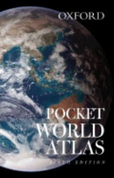
Paperback Pocket World Atlas Book

ISBN: 0195300262

ISBN13: 9780195300260

Pocket World Atlas

Select Format

Select Condition ThriftBooks Help Icon

Recommended

Format: Paperback

Condition: Very Good

$6.29
Save $10.66!
List Price $16.95
Almost Gone, Only 4 Left!

Book Overview

A handy pocket-sized book, conveniently bound in a durable yet flexible laminated cover, this new edition of the Pocket World Atlas contains full-color digitally produced maps as well as the latest... This description may be from another edition of this product.

Customer Reviews

4 ratings

Great value

For such a small package, this atlas really packs a lot! Indeed a great value for such a small price. I bought it along with Oxford's Concise World Atlas and couldn't be more pleased with both.

Excellent, except for the USA

This is an excellent and handsome pocket world atlas that I keep in my backpack whenever I'm travelling overseas. The maps themselves are fantastic, except for the USA. The problem is that the state boundaries are drawn with such a lightly-coloured red that you can't make them out. Adding to the difficulty is that the major highways are drawn with a dark red, further obscuring the states. The map of the north-east USA, for example, is practically illegible. This problem doesn't occur for other countries since the US is the only country with so many major internal states. The maps of other continents have a nice thick red line separating countries, which is important for Africa and Europe.It contains a pretty thorough gazetteer, showing the flag and some details of the world's countries (although some info may be out of date by the time you buy this; Afghanistan, for example, is detailed as saying "war is raging between the Taliban and the remainder of the government nations"). The book also contains small street maps of 20 cities across the world, including NY, Paris, London, Tokyo, etc. but they didn't include Los Angeles, Budapest, Prague, Beijing, Shanghai, or Moscow for some reason (but they do have Amsterdam and Brussels??). The page edges are gilded with a gold-like appearance. Really nice. Since I keep my book in my backpack all the time, I put it in a ziploc bag to keep the gilding from wearing out.Except for the problem with the states of the USA, this is an excellent book due to its appearance and small size. The poorly drawn maps of the USA aren't a big deal to me since I have larger reference atlases at home I use to look up funny little imaginary states like "Arkansas."

Super!

It's a hardcover pocket size atlas of the world! It's perfect for travelling, taking to school, and is very helpful! It has political and mostly physical maps of all the seven continents of the world. It also shows the major oceans, lakes, seas, bays, etc. Besides showing large mass' of land and water it also shows narrow rivers, and mountains. From the rocky mountains to the African Sahara, from snowy siberia to icy Antarctica, this atlas has maps of every single place in the world!

The Pocket World Atlas

This book makes a fantastic gift and you must order one for yourself. An attractive cover reveals accurate and visually pleasing maps of the world over. Maps are easy to find and read. A great choice!
Copyright © 2024 Thriftbooks.com Terms of Use | Privacy Policy | Do Not Sell/Share My Personal Information | Cookie Policy | Cookie Preferences | Accessibility Statement
ThriftBooks® and the ThriftBooks® logo are registered trademarks of Thrift Books Global, LLC
GoDaddy Verified and Secured