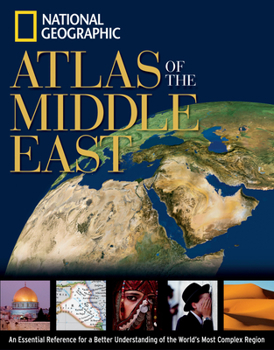
National Geographic Atlas of the Middle East
Select Format
Select Condition 
Book Overview
This book is a collection of new customized maps that address the important issues of the Middle East, known for its crossroads of faith and conflict. It will reveal the dramatic political, physical,... This description may be from another edition of this product.
Format:Paperback
Language:English
ISBN:0792250664
ISBN13:9780792250661
Release Date:March 2003
Publisher:National Geographic Society
Length:96 Pages
Weight:1.08 lbs.
Dimensions:0.3" x 8.5" x 10.9"
Related Subjects
Atlases Atlases & Maps Economics Environmental Economics General History Middle East ReferenceCustomer Reviews
5 ratings
National Geographic
Published by Thriftbooks.com User , 16 years ago
This was a gift for a world traveler. They have really enjoyed this book and I see it out whenever I visit them so I know they look at it often.
Jerusalem IS the capital of Israel
Published by Thriftbooks.com User , 18 years ago
A quick correction and a quick review: First, Jerusalem IS the capital of Israel. Most embassies continue in Tel Aviv, but Jerusalem became the capital in 1980. Second, the book likely has its flaws for various people. I would have liked to have seen a couple more major rivers in Iran. But for the price and the slick semi-glossy look one would be hard pressed to find a better, more inviting atlas. That said, a five star atlas would have to be more comprehensive. If NG had titled it A Concise Atlas ... and not subtitled it An Essential Reference for a Better Understanding ... I might have even given it a five. Still, solid book, recommended at the price.
EXCELLENT BUT...
Published by Thriftbooks.com User , 21 years ago
not very complete.The printing,paper and pictures are of the highest quality.The maps,classic "National Geographic" style,are good(Though I'd prefer Bertelsmann maps).But it's "Linguistic Groups Map" is highly inconsistent with "Ethnic Groups Map"(which is generally if not fully authenthic). For instance, in "Linguistic Groups Map" it is shown that in and around the Turkish province of "Siirt" the prevalent language is "Arabic" which is indeed true,but in "Ethnical Groups Map" that area is shown in "Kurdish" linguistic zone.However, the Turkish province of "Anteochea" which is shown as predominantly "Arabic" in its ethnicity,which is true,is shown in "Turkish" linguistic zone in "Linguistic Groups Map".Plus,the "Lazes"(an ethnic group named "Lazyges" in ancient times who are the Hellenized grandchildren of the ancient tribe known as "Sarmatians" along with "Roxolani") are not even mentioned in any of the maps or informative texts.The land(southeastern coasts of "Black Sea") on which they've been dwelling for thousands of years is unjustifiably included in "Turkish" ethnic and linguistic zones. Also,the maps of the selected cities(just six of them) are inadequate.They should have included Mecca,Medina(the two holy cities),Dubai,Abu Daby,Doha,Aden,Sanaa,Amman and Istanbul too.The historic maps are insufficient as well.There should have have been the maps of the region in pre-"19th century" and the "Ottoman Empire" at it utmost borders.The "Regional Conflicts,1945-2002" is good but could be better. Moreover, the "GDP per Capita" numbers for all the countries included are wholly wrong.Because they are taken from the "CIA World Fact Book".As they also mention in the "Acknowledgement" part, those GDP estimates are based on purchasing powers parity (PPP) conversion factor designed to equalize the purchasing powers of different countries.But unfortunately they do not reflect the real statistics.They could have taken the GDP estimates from the "United Nations Statistic Bureau" which gives the real levels of GDP.
a complete map review
Published by Thriftbooks.com User , 21 years ago
Both very simple and very complete to understand Today's Middle East boudaries economy and the fight for both oil and water done by each nation.Lots of maps and datas which can be easily unterstooden by foreigners who have an english school level.Made for kids in highschool, university students, teachers and also everybody who tries to understand Middle East by himself.A very good up-to-date.
A very useful reference
Published by Thriftbooks.com User , 21 years ago
This new atlas will be a very useful reference even after the invasion of Iraq is over. It contains a detailed map of each country in the area and of some major cities. The book also has a section of maps on "regional themes" such as climate, population, religion and resources, and a brief historical section.It is not perfect, however. It is inexplicable that there is no map of Istanbul, one of the largest cities in the region. Maps of Mecca and Medina should have also been included. A map of religious sites (p. 66) says that Jesus gave the Sermon on the Mount on (not near) the Sea of Galilee! The same map should also have identified Ephesus, associated with St. Paul, St. John and St. Mary. A few pre-twentieth century maps should also have been included, such as the Abassid Caliphate and the Ottoman Empire at their maximum areas. These maps would help show how the area, now so divided, was once much more unified.


