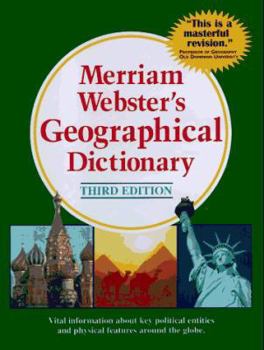
Merriam-Webster's Geographical Dictionary
Select Format
Select Condition 
Book Overview
A comprehensive source of geographical, economic, historical, and political information. Over 54,000 entries and 250 maps. Includes information on continents, countries, regions, cities, historical... This description may be from another edition of this product.
Format:Hardcover
Language:English
ISBN:0877795460
ISBN13:9780877795469
Release Date:January 1997
Publisher:Merriam-Webster
Length:1392 Pages
Weight:3.30 lbs.
Dimensions:1.7" x 7.2" x 9.8"
Customer Reviews
4 ratings
Like a Steady, Reliable Friend.
Published by Thriftbooks.com User , 17 years ago
I have used this book as a reliable geographical reference for years and never found it wanting. Both historic and modern places and geographic features are included. I have found everything I needed, from Ash Flat to Pskov. The appendix contains a thorough table of geographical terms in languages other than English, as well as a useful glossary.
Simply outstanding
Published by Thriftbooks.com User , 20 years ago
This is an excellent reference book that covers a myriad of geographical locations. The maps are also excellent. I highly recommend this book. A previous reviewer claims that the editors made an egregious mistake by including Slovenia as part of the Balkan states. Maybe that person should do a little research because virtually every resource, including Microsoft Encarta, includes Slovenia in the Balkans. And yes, the Ottomans did conquer Slovenia. The Ottomans had to surrender Slovenia, Hungary, and Croatia to the Hapsburgs in 1699. The editors of this book got it right on the money. As for that reviewer -- a little knowledge is a dangerous thing.
Superior geographical reference
Published by Thriftbooks.com User , 23 years ago
It is devoid of color and pretty representations of topography, but it has the best political maps I have ever seen and things like mountains, rivers, plateaus (I never knew there was something called Cockpit Country in Jamaica.), plains, bays, etc., etc., etc. indicated just with words, not artwork. To give the Jamaica example:the map shows more than 20 cities and towns, plus South Negril Point, Portland Point, South East Point, Montego Bay (of course), Bluefield Bay, Dolphin Head (1,788 ft), Blue Mountain Peak (7,393 ft), the Blue Mts., Dry Harbour Mts, Pedro Plains, Portland Bight, three named rivers and a passel of smaller ones not named on the map, and Jamaica Channel.There is a very good introduction on map projections, and clear symbols on the maps. 48,000 geographical entities are listed and described. Some no longer exist, but a thumbnail history is given, e.g. Nineveh, Lourenco Marques, now Maputo, the capital of Mozambique. Total of 252 maps, mostly of the countries of the world (with insets to show where the country is located in the world) and the states and provinces of the U.S. and Canada. The map of Japan, where I live, has an inset showing all 47 prefectures, numbered and identified in a list.The only drawback is that the size of the pages is B5. This makes the maps a little small, but they can always be increased in size with a magnifiying glass or a copy machine (being careful not to violate copyright laws, of course). They have such fine detail that increasing the size, say from B5 to B4, does not blur the details. And being the size of a Webster's Collegiate or maybe a little smaller, it is not exactly something you can balance on your little finger, but you could carry it in a backpack or small LL Bean canvas bag pretty comfortably.Finally, any place mentioned in one entry also has an entry of its own. For instance, I looked up Castellorizo, which is the English name for a Greek island that is the last in the Dodecanese chain and actually would logically seem to belong to Turkey from its location. This included references to the Dodecanese and to the island of Rhodes, both of which have their own listings. In addition, there is a bit of history of Castellorizo (and it's various spellings in the appropriate languages) indicating that it had been Greek, then Turkish, then Italian (1923) then back to Greece (1947). Your average atlas won't have that.As I said, it is not a beautiful book and it is not a textbook. But it has helped me many times to find where a place is, even places or areas easy to look up elsewhere but hard to see once you get the map because the lettering is obscured by artwork of brown mountains, green plains and blue lakes. This book assumes that you know that mountains are high, plains are flat and lakes have water in them that looks blue when the sky is clear.
Geographical Dictionary
Published by Thriftbooks.com User , 23 years ago
This book is very useful and as complete as can be expected for awork of its kind. Obviously it will be quickly outdated but will continue to serve a purpose for years to come. The level of detail is adequate given the limited scope that its size mandated. For smaller, less common places, a state place names index or local atlas, even a highway map would be a better resource. For international locations, perhaps National Geographic has a more detailed atlas. But these limitations must be expected and should not detract from the overall usefulness of this book.


