
Maps of the USA: Grades 1-6

Select Format
Select Condition 
Book Overview
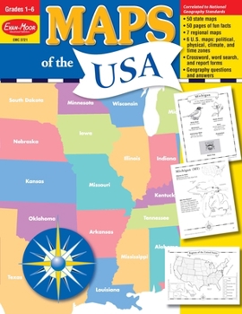
Maps of the USA contains geopolitical maps of each of the fifty states; political maps of the six regions; and political, physical, and thematic maps of the United States. You'll also find fun facts, geography bee-type questions, and review pages.
The book is divided into four sections:
The Fifty States
the state capital two most populous cities major rivers, mountains, and deserts and state bordersThe Six Regions
an outline map of the states in that region a small inset map of the United States with the region highlighted five questions about the region and a challenge research question 1 political reference map of the six regions of the United StatesThe United States
the fifty states, labeled and blank maps mountains and deserts waterways climate zones time zones maps showing the location of the United States in North America and the World a study sheet that includes ten questions about the map and a challenge research question accompanies each mapReview
a United States evaluation form a state evaluation form a crossword puzzle a word search and an answer keyThis resource contains teacher support pages, reproducible student pages, and an answer key. This is a reproducible resource (photocopying of lessons is permitted) for single classroom or individual home use only.
About Evan-Moor Educational Publishers
Igniting young minds to help every child learn and succeed Evan-Moor creates engaging and meaningful learning resources for children in grades PreK - 8. Trusted by parents and teachers for over 45 years, Evan-Moor's award-winning resources are thoughtfully developed to nurture children's hearts and minds to help them reach their full potential.
Customer Reviews
ThriftBooks ® and the ThriftBooks ® logo are registered trademarks of Thrift Books Global, LLC
