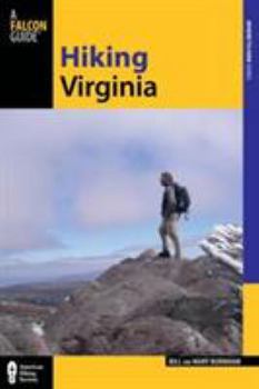
Hiking Virginia
Select Format
Select Condition 
Book Overview
Winner of a National Outdoor Book Award Honorable Mention, Hiking Virginia is indispensable for exploring the Commonwealth. Authors Bill and Mary Burnham breath fresh air into popular Virginia... This description may be from another edition of this product.
Format:Paperback
Language:English
ISBN:0762778024
ISBN13:9780762778027
Release Date:February 2013
Publisher:Falcon Press Publishing
Length:351 Pages
Weight:1.55 lbs.
Dimensions:0.8" x 5.9" x 8.9"
Customer Reviews
4 ratings
Discover or rediscover a beautiful state
Published by Thriftbooks.com User , 15 years ago
Whether you're a longtime resident of Virginia or just moving to the commonwealth, "Hiking Virginia" is an excellent overview of the opportunities the state offers for the intrepid. With little or no admission price, these hikes deliver experiences ranging from the subtle austerity of the York River in December to the grand vistas of the Blue Ridge Mountains. Bill and Mary Burnham divide the hikes by region -- Eastern Virginia, Northern Virginia, Central Virginia, Shenandoah National Park, Valley & Ridge, Southwest Highlands, Mount Rogers National Recreation Area and the Appalachian Trail through Virginia. It's great to find authors who don't limit themselves to the more summoning treks into the mountains. Even urban Northern Virginia has gems tucked into its geography for those willing to find them. The authors write with the hiker in mind. Each section starts with an overview and includes information including directions to the trailhead, nearby lodging, history, and a convenient Miles and Directions listing with mile-by-mile pointers. Elevation profiles and route maps as well as `grades' for the hikes from easy to difficult aid in preparation. I usually scan and print sections rather than lugging the entire book along. "Hiking Virginia" is a concise guide to the entire state. It includes everything you'll need to launch your own explorations. Don't forget the appeal of off-season hikes in the winter -- fewer people and the stark beauty of the landscape.
Detailed, thorough, enjoyable.
Published by Thriftbooks.com User , 18 years ago
This book is your complete hiking guide to Virginia, whether you're a novice or a pro. There are maps, detailed descriptions of every step of the trails, elevation guides, and even colorful anecdotes from the authors that give each hike an emotional feel. We've brought their step-by-step guides to great fruition on several of the hikes, and hope to do more. One word of caution: while crowded Northern Virginia is well represented, the best hikes fall along Virginia's spine, from the northernmost part of Shenandoah National Park, down the Appalachian trail, into Washington and Jefferson National Forests and then southwestern Virginia and Mt. Rogers. Residents of Front Royal, Harrisonburg, Staunton, Lexington, Roanoke and Blacksburg will be able to access the best hikes the easiest. As residents of a DC suburb, it's an hour to Shenandoah National Park, 2 hours to some of the great hikes further south, and 6 hours to Mt. Rogers National Recreation Area.
By far the best hiking guide for Virginia
Published by Thriftbooks.com User , 18 years ago
This book is by far the best hiking guide you can buy for Virginia. This edition picks off from the original "Hike America Virginia"
I highly recommend this book...
Published by Thriftbooks.com User , 19 years ago
For anyone looking for great hikes in VA, this is a great place to start. The book contains detailed descriptions of 35 of the best hikes in VA and also list 64 honorable mention hikes. The length of the hikes vary from short day hikes, to 3 day backpacking trips. What is nice about the book is that for the featured hikes, there is a brief description. Then a ton of information: difficulty rating, available maps, trail contacts, and fees or permits required, available camping etc etc. The book then goes on to describe in detail what you will see on each hike. Each hike contains not only a map, but an 'elavation profile' so you can gauge just how hard the hike will be. I would recommend buying this book, and when you choose a hike, make a copy of the corresponding pages and laminate them. It will save wear and tear on your book as well as give you a water proof map.. Besides, it's also a lot lighter to carry 3 pages rather then a whole book!!!! My favorite hikes in the book have been Mount Pleasant, 3 Ridges (a difficult hike) and the hikes around Mount Rogers and Grayson Highlands. UPDATE: I recently did a few more of the hikes in this book(14, 18, 19). DO NOT, I REPEAT, DO NOT follow the authors' advice for the Old Rag hike, #14. Instead of their route, either 1) Hike the fire road up and down (this is the easiest way) or take the rock scramble up and the fire road down. There are two problems with the route suggested by the authors. First, on crowded summer days you will have a hard time getting down as the trail is jammed with people going up. Second, I went during the week when it wasn't as packed and ran into a gentleman going up the scramble as I was going down. He told me that 90% of the people they carry off of the mountain with broken bones are trying to descend using the 'rock scramble' route. So if you are going to climb Old Rag (and YOU REALLY NEED TO, it is amazing) then PLEASE, use the routes I recommended above, and if it's a weekend during the summer, be prepared for a long climb up if you take the rock scramble, as people get jammed up in the narrow crevices. Good hiking everyone!!!!!!


