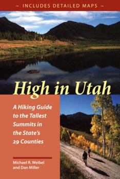
High in Utah
If you measured the highest point in each county, which of the fifty states would have the highest average elevation? You probably didn't say Utah, but in fact the average elevation of the state's... This description may be from another edition of this product.
Format:Paperback
Language:English
ISBN:0874805880
ISBN13:9780874805888
Release Date:January 1999
Publisher:University of Utah Press
Length:174 Pages
Weight:0.65 lbs.
Dimensions:0.5" x 6.0" x 9.0"
Related Subjects
Adventure Excursion Guides General Hiking & Camping Mountain Mountain Climbing Mountaineering Travel Utah WestCustomer Reviews
3 ratings
County highpoints in Utah
Published by Thriftbooks.com User , 18 years ago
This book is an excellent guide for anyone who wants to complete the highpoints of Utah's 29 counties. For "true" county highpointers, the goal is to get to the highest point in each county. Sometimes this is along a boundary line with an adjacent county (a so-called liner). These liners are distinct from the highest summit in some counties. Wiebel and Miller provide both the highest points and the highest summits. The book is complete with descriptions of approaches and hikes to the highpoints. Although a map and compass (and the knowledge to use them) is always needed, the book is complete on its own. Highly recommended.
High Enough...
Published by Thriftbooks.com User , 23 years ago
If your goal is to 'bag' the highest peak in each of the counties listed, then this is THE book to use. While not as thorough as Kelsey's (and the authors admit that, because the goal is to make it simple) the information provided is more than sufficient. The photos don't really show the routes (like Roach's Colorado books) but do give the 'atmosphere' of the climb. I've done a few out of the book, and plan on doing the rest as time allows. I think it's a nifty idea, and would recommend it to anyone with any experience level at all in the mountains (and especially anyone who wishes to drive to the top and sit on the roof of the car to gain more altitude ;).
High in Utah
Published by Thriftbooks.com User , 24 years ago
This book is excellent. It is loaded with information on 30 Utah mountains. The description for each mountain includes hiking time (a range for both fast and slow hikers), distance, difficulty, starting elevation, elevation gain, USGS map, trialhead, Camping, tips and precautions, the hike, background, and where to find more information. The book also includes various pictures for each mountain and two maps including the mountian and how to get to the trialhead. The book is not only helpful as a guide but fun to read and enjoy the pictures. I have found it to be the best all-round guide to Utah mountains on the market.


