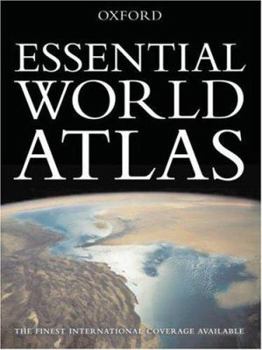
Essential World Atlas
Select Format
Select Condition 
Book Overview
With one hundred pages of superbly crafted maps covering the globe, the Essential World Atlas highlights the best aspects of Oxford's atlas line in a handy and affordable paperback format. Now in its fourth edition, the Atlas has been expanded to include island maps of Trinidad and Tobago, Jamaica, Puerto Rico, St. Lucia, the Virgin Islands, Barbados, the Whitsunday Islands, Singapore, Pinang, Ko Phuket, Ko Samui, and Bali. New to the Atlas is the World in Focus thematic section, which contains 32 pages about our planet's human and natural systems. In addition, the Atlas has been redesigned with a new cover, and a fresh interior layout, making it more user-friendly than ever. The locator maps have been improved and tabs indicating adjacent map pages have been included to make cross-referencing more efficient. Meticulously crafted and thoroughly updated, the Essential World Atlas Fourth edition continues to be an indispensable resource. Features - A 32-page World in Focus section, highlighting the world's human and natural systems - New island maps of exotic locations such as Bali, Trinidad and Tobago, and the Whitsunday Islands - Improved locator maps and adjacent map tabs - Easy-to-use indices with letter-figure grid references and full geographic coordinates - World statistics, survey data and colorful representations of flags from around the world - International in scope, with fully updated coverage of every part of the world
Format:Paperback
Language:English
ISBN:0195313224
ISBN13:9780195313222
Release Date:October 2006
Publisher:Oxford University Press, USA
Length:176 Pages
Weight:2.55 lbs.
Dimensions:0.7" x 9.0" x 12.2"
Customer Reviews
3 ratings
Best graphics medium-sized Atlas
Published by Thriftbooks.com User , 14 years ago
I am a map lover and lived and explored many countries with always a map in my hands. I went to get a basic Atlas for my 9 yr old kid and choose among the many this Oxford Essential for the following reasons: 1) great clear and easy to read graphics. Mountains and plains are immediate to the eye, rivers are easy to follow and clearly named. Towns and cities are evident but do not obscure the geography. Not too many nor too few names on maps. Very well readable 2) Each page has a complete geographic area. The bigger version of this Atlas, called Oxford World Atlas and priced 3 times more, has bigger maps but fractions countries like England, Spain etc in a way that the reader cannot get the overall picture in his geographic mind. If you want that kind of detail you better go on google maps. 3) Not confusing. It is not burdened by color photos of people and landscapes on each page like other Atlases are that mix maps with photos with a result that is more suitable for a travel magazine. 4) It has a few air photos and (too) many detailed city maps. 5) Decent price and small enough size to be portable and storable easy. A very well balanced item, indeed. Only fault: it lacks the wonderful Ocean floor maps that constitute 3/4 of our earth!!
Oxford Essential World Atlas, Third Edition
Published by Thriftbooks.com User , 20 years ago
This is my favorite atlas of the many I possess. It is lightweight enough to carry, the colored pictures are big enough to see, it includes mapped routes of large cities and includes relief maps as well as satellite photographs. Inside the covers are all the flags of the world. Included are world statistics of the countries and physical dimensions, a User Guide and Index. This Atlas would be wonderful for a family, college student or anyone doing business internationally.
A decent reference for a very reasonable price
Published by Thriftbooks.com User , 23 years ago
I ordered this book as a Christmas gift for grandparents, and they have loved it. It has enough information and detail to look up places you read about in books or hear about on TV, etc. If you want an extremely detailed heavy-duty reference, this may not be your best choice. However, if all you want is a nice sized, decent altas, this works. The first part has great detail on the US and the second half details the world. One nice feature is that in the upper corner of the maps you see a tiny map with a sligthly larger view-point with page numbers. So, if you're looking at the far right side of the page and getting to the end of the map, this tiny map tells you on what page the map "continues", if you will.My only gripe about this atlas is that it is bound as a regular book and thus it is hard to read things that are in the middle crack. It would be much nicer if the book were bound with a spiral or had margins on the inside so that the crack of the book didn't hide things.


