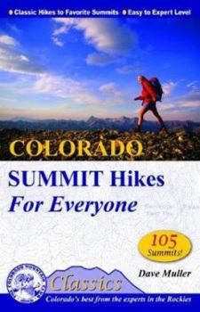
Colorado Summit Hikes for Everyone
Select Format
Select Condition 
Book Overview
* Contains detailed information for reaching 105 named summits, from peaks suitable for beginners to famous, 14,000-foot Capitol Peak. * Full-color guidebook * One of the first two titles in a new series from the Colorado Mountain Club: CMC's Classics From world-renowned Rocky Mountain National Park in the north to the magnificent San Juans in the southwest, from the famed peaks above Aspen to the remote tops of the Sangre de Cristos, no other state...
Format:Paperback
Language:English
ISBN:0972441336
ISBN13:9780972441339
Release Date:October 2003
Publisher:Colorado Mountain Club
Length:224 Pages
Weight:0.90 lbs.
Dimensions:0.5" x 5.5" x 8.4"
Customer Reviews
1 rating
A Must-Have for Those Who Enjoy Summits
Published by Thriftbooks.com User , 15 years ago
This is a great book of summit hikes ranging in difficulty from fairly trivial (less than a mile round trip, with only a few hundred feet of elevation gain) to very demanding (14 or more miles round trip with over 5,000 feet of elevation gain). I particularly found it useful when I had some time, but not enough for a very challenging hike, and wanted a summit. The map showing where all the hikes are located allows one to easy find one nearby at an appropriate difficulty (which is also a measure of time required). Among the book's other positive features are good trailhead directions, clear maps, accurate hike descriptions, interesting other tidbits of local history, elevation profiles (a graph showing how much elevation is gained at what distance on the hike), "peak finders" (circles showing what peaks are in which direction when one is standing at the summit), and a decent photo from each hike. The book could use improvement in a few of areas - adding topographic detail to the maps, updating trailhead information, and removing the misleading estimated times (maybe they were the author's best times, but are very unrealistic for the "everyone" to whom the book is marketed). At least one trailhead where the book said "a regular car can make it this far" I would strongly disagree, unless the driver didn't mind risking damaging it by bottoming it and potentially backsliding. At another trailhead I had to make my way around a chain saying the area was closed. Another minor annoyance was the fact that the maps used the interstate symbol to represent US routes - while US 40 runs through Colorado, I-40 runs quite a bit further south. Overall, this book has tons of great information (even if some is out of date) that it makes easily accessible. I know it will accompany me on all my future trips to Colorado.


