Skip to content
Scan a barcode
Scan

National Imagery and Mapping Agency

Follow to get improved recommendations.

Books by National Imagery and Mapping Agency

Sight Reduction Tables for Marine Navigation-Commercial Edition (Latitudes 15-30, inclusive, Volume 2 0970801041 Book Cover

Sight Reduction Tables for Marine Navigation-Commercial Edition (Latitudes 15-30, inclusive, Volume 2

National Imagery and Mapping Agency

$12.89

International Code of Signals: For Visual, Sound, and Radio Communication 0914025228 Book Cover

International Code of Signals: For Visual, Sound, and Radio Communication

National Imagery and Mapping Agency

$16.35 - $29.02

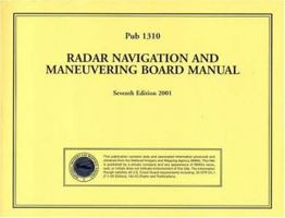
PUB1310 Radar Navigation and Maneuvering Board Manual 1577852486 Book Cover

PUB1310 Radar Navigation and Maneuvering Board Manual

National Imagery and Mapping Agency

Out of Stock

Pub102, International Code of Signals, 2005 Edition Revised 1577854624 Book Cover

Pub102, International Code of Signals, 2005 Edition Revised

National Imagery and Mapping Agency

Out of Stock

PUB107 Atlas of Pilot Chart: South Pacific Ocean (4th Edition) 1577852028 Book Cover

PUB107 Atlas of Pilot Chart: South Pacific Ocean (4th Edition)

National Imagery and Mapping Agency

Out of Stock

PUB108 Atlas of Pilot Chart: North Pacific Ocean (3rd Edition) 1577852036 Book Cover

PUB108 Atlas of Pilot Chart: North Pacific Ocean (3rd Edition)

National Imagery and Mapping Agency

Out of Stock

Chart No. 1 1467993468 Book Cover

Chart No. 1

National Imagery and Mapping Agency

Out of Stock

Sight Reduction Tables For Marine Navigation 45-60, Inclusive Pub. No. 229 Volume 4 0970801068 Book Cover

Sight Reduction Tables For Marine Navigation 45-60, Inclusive Pub. No. 229 Volume 4

National Imagery and Mapping Agency

Out of Stock

PUB 249 Sight Reduction Tables for Air Navigation, Volume 3: Latitudes 39° to 89° Declinations 0° to 29° 157785196X Book Cover

PUB 249 Sight Reduction Tables for Air Navigation, Volume 3: Latitudes 39° to 89° Declinations 0° to 29°

National Imagery and Mapping Agency

Out of Stock

PUB 229 Sight Reduction Tables for Marine Navigation, Volume 4: Latitudes 45° - 60°, Inclusive B0015ZR7NM Book Cover

PUB 229 Sight Reduction Tables for Marine Navigation, Volume 4: Latitudes 45° - 60°, Inclusive

National Imagery and Mapping Agency

Out of Stock

PUB105 Atlas of Pilot Chart: South Atlantic Ocean (2nd Edition) 1577852001 Book Cover

PUB105 Atlas of Pilot Chart: South Atlantic Ocean (2nd Edition)

National Imagery and Mapping Agency

Out of Stock

Sight Reduction Tables For Marin Navigation Pub. No. 229 Volume 6 75-90 Inclusive 0970801084 Book Cover

Sight Reduction Tables For Marin Navigation Pub. No. 229 Volume 6 75-90 Inclusive

National Imagery and Mapping Agency

Out of Stock

Red Sea and the Persian Gulf (Sailing Directions [Enroute] Pub. 172) B000P5MZ30 Book Cover

Red Sea and the Persian Gulf (Sailing Directions [Enroute] Pub. 172)

National Imagery and Mapping Agency

Out of Stock

PUB191 Sailing Directions: Enroute, 2004 English Channel (Enroute) (11th Edition) 1577855647 Book Cover

PUB191 Sailing Directions: Enroute, 2004 English Channel (Enroute) (11th Edition)

National Imagery and Mapping Agency

Out of Stock

Pub. No. 229 VOL 5 : Sight Reduction Tables for Marine Navigation Latitudes 60-75 Inclusive 0970801076 Book Cover

Pub. No. 229 VOL 5 : Sight Reduction Tables for Marine Navigation Latitudes 60-75 Inclusive

National Imagery and Mapping Agency

Out of Stock

Sight Reduction Tables for Marine Navigation (Pub 229) VOL. 1 0970801033 Book Cover

Sight Reduction Tables for Marine Navigation (Pub 229) VOL. 1

National Imagery and Mapping Agency

Out of Stock

2005 Radio Navigational Aids (Pub117) 1577855361 Book Cover

2005 Radio Navigational Aids (Pub117)

National Imagery and Mapping Agency

Out of Stock

PUB 229 Sight Reduction Tables for Marine Navigation, Volume 3: Latitudes 30° - 45°, Inclusive B01K047BK2 Book Cover

PUB 229 Sight Reduction Tables for Marine Navigation, Volume 3: Latitudes 30° - 45°, Inclusive

National Imagery and Mapping Agency

Out of Stock

The American Practical Navigator: Bowditch 1607965046 Book Cover

The American Practical Navigator: Bowditch

National Imagery and Mapping Agency

$41.46

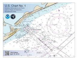
U.S. Chart No. 1: Symbols, Abbreviations and Terms Used on Paper and Electronic Navigational Charts 1937196976 Book Cover

U.S. Chart No. 1: Symbols, Abbreviations and Terms Used on Paper and Electronic Navigational Charts

National Imagery and Mapping Agency

$23.29

Copyright © 2024 Thriftbooks.com Terms of Use | Privacy Policy | Do Not Sell/Share My Personal Information | Cookie Policy | Cookie Preferences | Accessibility Statement
ThriftBooks® and the ThriftBooks® logo are registered trademarks of Thrift Books Global, LLC
GoDaddy Verified and Secured